⚡ Heads up: This post contains affiliate links. If you book or buy through them, we may earn a small commission — at no extra cost to you. We only recommend stuff we’d actually use ourselves.
TL;DR: The Laugavegur Trail runs around 55 km from Landmannalaugar to Þórsmörk across Iceland’s southern highlands, and most hikers walk it in four days and three or four nights. For the 2026 season, a bunk in an Iceland Touring Association (Ferðafélag Íslands) hut costs around ISK 15,800 per person per night, while a tent pitch runs roughly ISK 3,200–3,400 — and for the first time, both huts and campsites need to be booked in advance.
This is the hike people picture when they imagine Iceland: rhyolite mountains striped orange, pink and green, steam hissing out of black gravel, then an abrupt switch into glacial desert and braided rivers you wade barefoot. It is also a trek that punishes people who wing it. Beds sell out in January, the weather above 900 m can turn to sleet in July, and the bus that gets you to the trailhead only runs for a narrow summer window.
Below is the full picture for 2026: the route stage by stage, what each night actually costs, how the new booking rules work, and the gear and safety calls that matter more than your Instagram grid. Written by the WanderFunTrip editorial team — last updated 12 September 2026, with pricing and schedules checked against Ferðafélag Íslands and Icelandic highland bus operators.
What Is the Laugavegur Trail — and How Hard Is It Really?
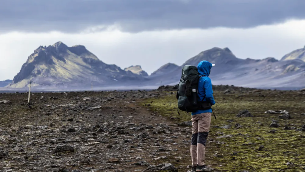
The Laugavegur Trail is a roughly 55 km hut-to-hut trek through Iceland’s Fjallabak Nature Reserve, running from the geothermal valley of Landmannalaugar in the north to the birch woods of Þórsmörk in the south. It is Iceland’s most walked multi-day route, and the reason is simple: no other trail in the country packs this many landscape changes into four days of walking.
Difficulty is where most people misjudge it. Technically, the trail is not hard — there is no scrambling, no exposure, no via ferrata, and the path is marked with posts the entire way. What makes it demanding is the combination of factors that stack up:
- Cumulative ascent. Day one climbs roughly 470 m from Landmannalaugar to the Hrafntinnusker plateau, much of it on loose volcanic scree and, in early season, packed snow.
- Unbridged river crossings. You will wade. Depth and speed change daily with glacial melt and rain.
- Weather that ignores the calendar. Hrafntinnusker sits at around 1,050 m and can hold snow well into July. Horizontal rain and near-zero visibility are normal, not exceptional.
- Pack weight. There are no shops on trail. Whatever you eat for four days, you carry from Reykjavík.
If you have done any multi-day trek with a 12–15 kg pack — an Alpine hut tour, the West Highland Way, a section of the Tour du Mont Blanc — you have the engine for Laugavegur. If your longest hike is a day trip, book the four-day version rather than trying to compress it into three, and read our wild camping gear and rules guide before you start buying kit.
Direction matters too. Around 80% of hikers walk north to south, Landmannalaugar to Þórsmörk, because it means net elevation loss and finishing in a sheltered, green valley with a bar. Walking south to north is legal, quieter, and harder.
[IMAGE]
How Many Days Does the Laugavegur Trail Take?
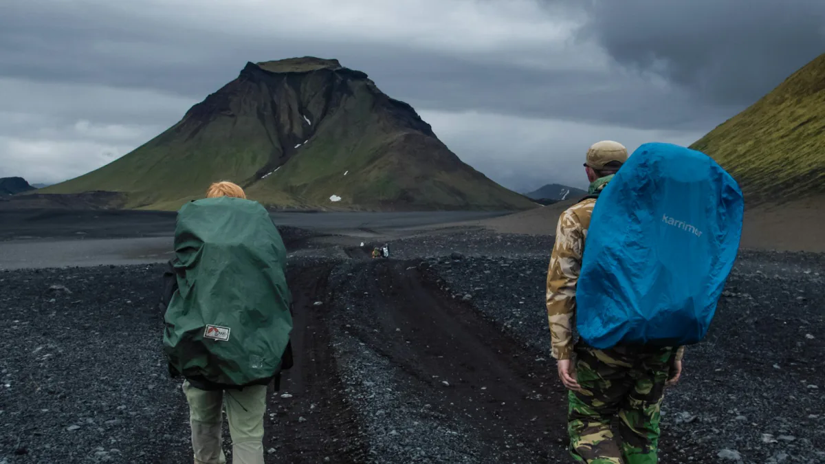
Four days and three nights is the standard schedule, and it is what the hut spacing is designed around. Fast, experienced hikers combine the first two stages and finish in three days; anyone who wants time for side trips to ice caves, hot springs or the Þórsmörk viewpoints should plan five.
Here is the classic north-to-south breakdown, with approximate distances and walking times for a hiker carrying a full pack:
| Stage | Approx. distance | Approx. time | What you walk through |
|---|---|---|---|
| Landmannalaugar → Hrafntinnusker | approx. 12 km | 4–5 hrs | Laugahraun lava field, Brennisteinsalda sulphur vents, snowfields |
| Hrafntinnusker → Álftavatn | approx. 12 km | 4–5 hrs | Obsidian ridges, big descent, first lake views |
| Álftavatn → Emstrur (Botnar) | approx. 15 km | 6–7 hrs | Hvanngil, black-sand desert, first serious river ford |
| Emstrur → Þórsmörk | approx. 15 km | 6–7 hrs | Markarfljót canyon, Þröngá crossing, birch forest |
There is a sixth hut at Hvanngil, roughly 5 km past Álftavatn, which most hikers walk straight past. It is worth knowing about: if Álftavatn is fully booked, Hvanngil is the fallback that keeps your schedule intact.
Want more? The Fimmvörðuháls extension adds roughly 25 km from Þórsmörk over the pass between Eyjafjallajökull and Mýrdalsjökull, past the 2010 eruption craters, finishing at Skógafoss. It is a serious day — around 1,000 m of ascent — and it turns the trek into a five- or six-day trip. Only add it if your legs are still working on day four.
[IMAGE]
Laugavegur Huts vs Camping: Which Should You Book for 2026?
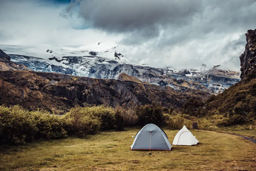
Book huts if you want a mattress, a kitchen and a guaranteed dry night; book campsites if you want to save roughly 75% of your accommodation budget and you own a tent that survives sustained wind. The single biggest change for the 2026 season is that campsites now require advance reservations too — through 2025 you could simply turn up and pitch, and that is no longer the case.
The huts along the route are run by Ferðafélag Íslands (the Iceland Touring Association) and share the same basic format: shared sleeping platforms or bunks with mattresses, a communal kitchen with gas hobs and cookware, cold running water, and a warden on site through the season. You bring your own sleeping bag — there is no bedding. There is no electricity for charging in most huts, no food for sale, and no showers at several of them.
Huts, in practice:
- Sleeping is dormitory-style and close quarters — earplugs are not optional
- Boots come off at the door; there is a drying area for wet gear
- Wardens post weather forecasts and river-crossing conditions daily
- Bunks for July and August routinely sell out within weeks of booking opening
Camping, in practice:
- You pitch in designated areas beside each hut and use the hut’s toilets
- Kitchen access is generally not included — assume you cook outside on your own stove
- Pitches are exposed; bring a proper four-season-capable tent, not a festival dome
- Hrafntinnusker is the coldest, highest and windiest night of the trek by a wide margin
A practical hybrid that a lot of experienced trekkers use: camp the three lower nights and book a hut bunk at Hrafntinnusker, where the weather is worst and the payoff for a solid roof is highest. Note that Emstrur has some booking quirks — certain options there can’t be reserved through the standard online system and need an email to the association instead, so check before you assume your itinerary is locked.
Book the moment reservations open for the season. Independent hikers compete for the same beds as guided groups, and the guided operators block-book early.
[IMAGE]
Enjoying This?
Get more guides like this — plus flight deals — sent straight to your inbox.
How Much Does the Laugavegur Trail Cost in 2026?
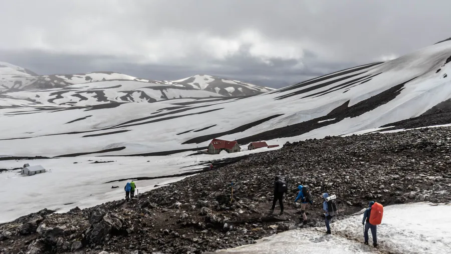
Budget roughly ISK 75,000–95,000 (approx. €510–650) for a self-guided four-day hut trek including transport, or roughly ISK 40,000–50,000 (approx. €270–340) if you camp — excluding flights to Iceland and gear. Guided packages with luggage transfer and meals sit far higher, typically several times those numbers.
Here is where the money actually goes, based on 2025/26 season pricing:
| Cost item | Approx. price (ISK) | Notes |
|---|---|---|
| Hut bunk, per person per night | around 15,800 | approx. US$122; ×3 nights for the standard route |
| Tent pitch, per person per night | around 3,200–3,400 | approx. €22–23; reservation now required for 2026 |
| Reykjavík → Landmannalaugar bus (one way) | from around 12,220 | 4×4 highland bus; season-limited |
| Hikers Bus Pass (both transfers) | around 27,900 | Covers Reykjavík in and out, Landmannalaugar / Þórsmörk / Skógar |
| Four days of trail food (supermarket) | around 10,000–18,000 | Far cheaper than imported freeze-dried meals |
Two easy savings. First, buy your food at a discount supermarket in Reykjavík rather than at the airport or an outdoor shop — Icelandic freeze-dried pouches are brutally expensive. Second, treat your flight as the variable you can actually control: highland accommodation prices are fixed, but airfare to Keflavík swings hard by month and by day of week. It is worth running flexible dates when you compare flights to Reykjavík, because shifting your trek by a few days in shoulder season can pay for an entire night in a hut. Our Iceland glacier hiking guide covers another highland day out worth bolting on.
[IMAGE]
What Gear, Weather and River Crossings Should You Prepare For?
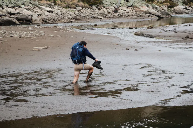
Prepare for cold rain, strong wind and at least three barefoot river fords, in any week of the summer season. The Laugavegur is not a technical trail, but it is an exposed one, and almost every rescue call on it traces back to the same three things: inadequate layers, a river misjudged, or a schedule that refused to bend to the forecast.
The season. The trail is realistically walkable from roughly late June to early September. Highland bus access in 2026 runs from around 13 June to 20 September, which is a good proxy for the window. Late June means the easiest river crossings — glacial melt is at a seasonal low — but the most lingering snow above 900 m near Hrafntinnusker. Late August means clearer paths and fuller rivers.
River crossings. Unbuckle your hip belt before you step in, so you can shed the pack if you go down. Face upstream, shuffle sideways, use poles, and cross wide shallow braids rather than narrow deep channels. Water sourced from glaciers is genuinely numbing — dedicated crossing shoes or sandals plus a small towel make a real difference to morale. If a river looks wrong to you, it is wrong. Wait, or ask the hut warden.
Non-negotiable kit:
- Properly waterproof shell jacket and trousers — not a water-resistant softshell
- Sleeping bag rated for around 0 °C or lower, even in huts
- Trekking poles (they do half the work at the river fords)
- River-crossing footwear plus a quick-dry towel
- Hat, gloves and a warm mid-layer, in July, without exception
- Offline maps and a paper backup — visibility on the Hrafntinnusker plateau can drop to a few metres
One more line item people skip and regret: insurance. Iceland’s search-and-rescue teams are volunteer-run and do not invoice you for a mountain rescue, but a twisted ankle on day two still means evacuation logistics, a missed flight and a rebooked trip. Check that your policy actually covers unguided multi-day trekking rather than just “hiking” — plenty of standard travel policies quietly exclude it. If yours does, adventure travel insurance built for trekking is a small cost against a highland trip you have already paid for in full.
[IMAGE]
Laugavegur Trail FAQ
Do I need a guide for the Laugavegur Trail?
No — the Laugavegur is well marked with posts and cairns, and thousands of people walk it unguided every summer. A guide is worth considering if you are hiking solo with no experience of river crossings, or if you want luggage transfer between huts. In poor visibility on the Hrafntinnusker plateau, navigation skills matter more than trail markings.
When does Laugavegur hut booking open for 2026?
Ferðafélag Íslands opens its online booking for the following season well ahead of summer, and popular July and August dates disappear fast. For 2026 you must reserve campsites as well as huts, which is a change from previous years. Set a reminder and book on the day it opens if you need specific dates.
Can you hike the Laugavegur Trail in three days?
Yes, by combining Landmannalaugar to Álftavatn into one 24 km day and keeping the two southern stages as they are. This is a realistic plan for fit hikers with light packs and a stable forecast. It removes all buffer, so a single bad-weather day can wreck the schedule.
Is there mobile signal or Wi-Fi on the trail?
Coverage is patchy and should not be relied on. Some huts and high points get intermittent signal, but long stretches — particularly the descent toward Emstrur — have none. Download offline maps before you leave Reykjavík and tell someone your itinerary.
How cold does it get on the Laugavegur Trail in summer?
Summer daytime temperatures on the trail are typically in the single digits to low teens Celsius, and nights at Hrafntinnusker can drop to around or below freezing. Wind chill is the real factor — an exposed ridge in sustained wind feels dramatically colder than the thermometer suggests. Snow in July is unusual but not shocking at altitude.
Which direction should I walk the Laugavegur Trail?
North to south, from Landmannalaugar to Þórsmörk, is the standard choice and what most hut bookings and bus timetables assume. It gives you net descent and finishes in a sheltered valley with facilities. South to north is quieter but means more climbing with a heavier pack on day one.
[IMAGE]
Ready to Walk Iceland’s Most Famous Trail?
The Laugavegur rewards planning more than fitness. Nail three things — beds or pitches booked the week reservations open, bus transfers locked at both ends, and a shell layer that genuinely keeps rain out — and the rest of the trek is four days of walking through landscapes that look computer-generated until you are standing in them.
Your next move depends on the calendar. If you are targeting the 2026 season, start with the dates: pull up flexible-date fares, find the cheapest week that lands inside the highland bus window, and only then book your huts around it. Check current fares to Keflavík, pick your week, and get the Ferðafélag Íslands booking page open the morning reservations release — the difference between a planned Laugavegur and a postponed one is usually about 48 hours of hesitation.
Never Miss a Deal
Get the best travel tips, festival guides & flight deals straight to your inbox.

Gbuska is the founder and lead writer at WanderFunTrip. What began as one too many 3 a.m. festival fields and a $40 flight booked on a whim turned into a full-time habit of testing adventure trails, party cities, and adults-only resorts firsthand — then writing up what actually worked (and what didn't). Every guide here starts from a real trip or a real booking, never a press release. Usually somewhere between a departures board and the next cliff jump.